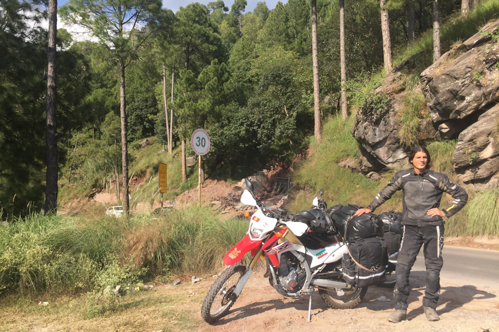
Relaxed and very motivated, we ride into the mountains after our little rest in Islamabad. However, before we leave the town, we have to get some cash. A few ATMs later, many are empty for unknown reasons or don’t give any money, we are finally ready to continue our journey. Suddenly two young men start speaking to us and want to invite us for a drink. Half an hour later we say goodbye and agree to contact them as soon as we return to Islamabad on our way back.
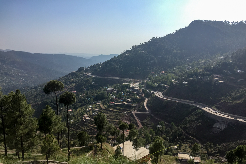
A small pass road winds its way up to Murree. This area is a recreational area for the people of Islamabad. Many locals come here to escape the heat in the valley in this cooler and very green mountain region. Accordingly, it is quite crowded and very expensive. We do a little lap through the town, but finally ride along a small side road towards Muzaffarabad.
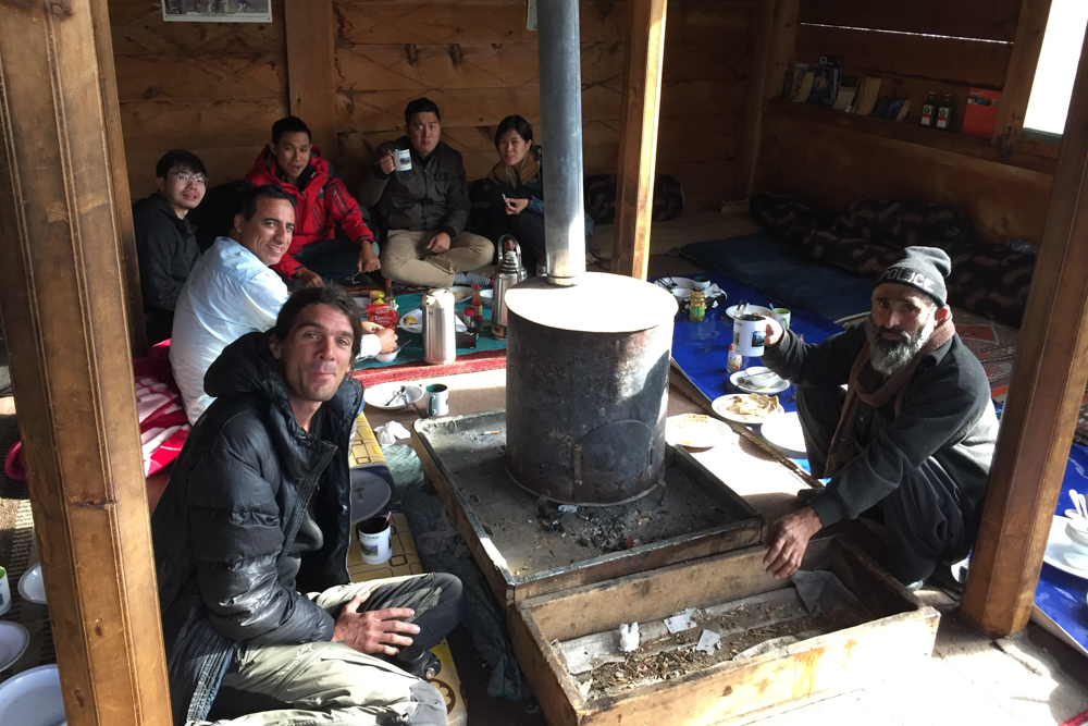
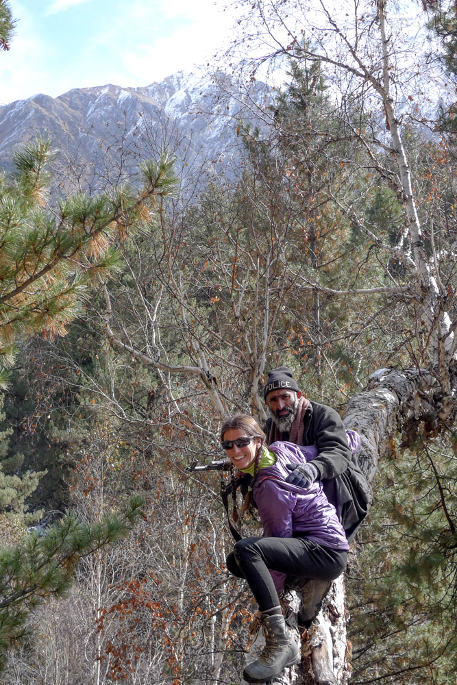
A few kilometers later we are invited for dinner in a small village. When our stomachs are nicely filled, it is already getting dark and we have to look for a place to sleep. The little road runs right along the slope and it is difficult to find a place for the tent, since there isn’t really a flat spot. Therefore we decide to turn into a smaller side road, but after a few adventurous switchbacks, we end in a dead end with private properties. As we are turning around, an astonished woman comes out of one of the houses and starts talking to us. While we explain to her, that we are looking for a place to pitch our tent, we already hear her husband calling out to ask us to stay with them. Before we can make our own decision, our luggage is already removed and carried into the house – there is no further argument *haha*.
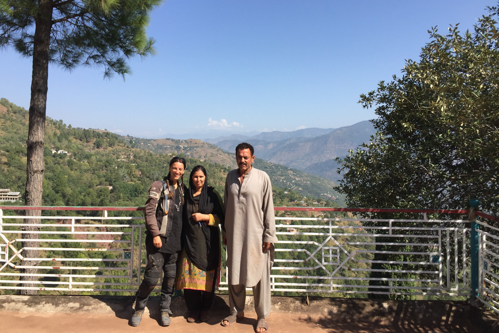
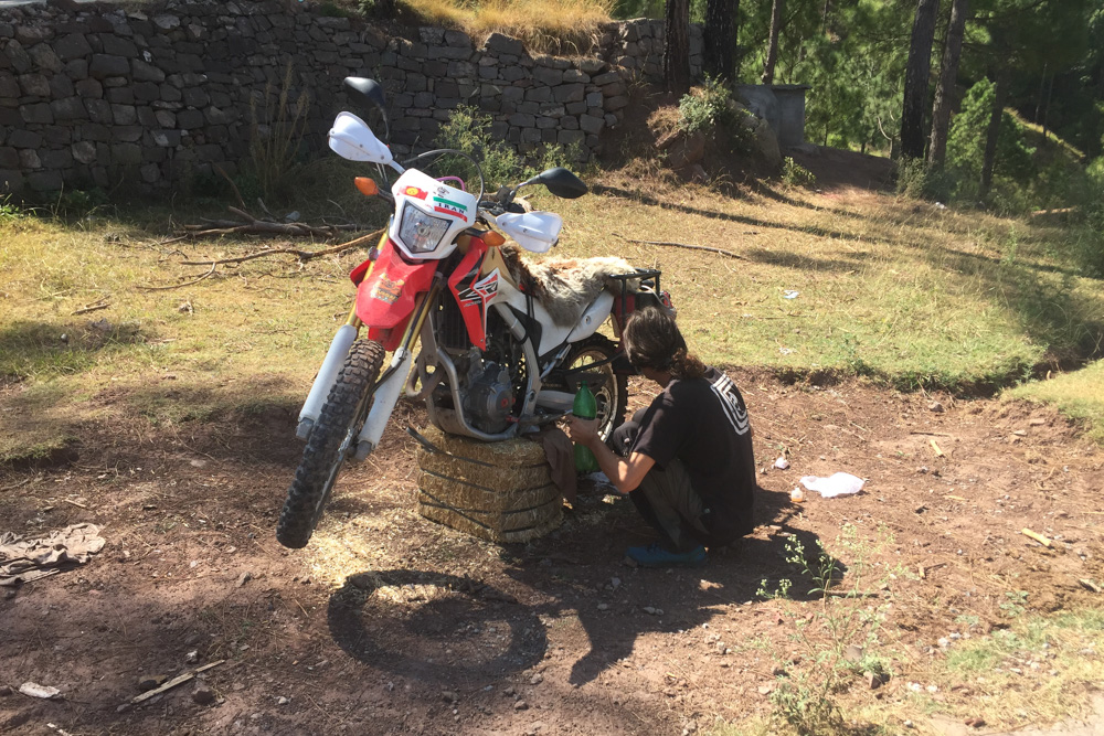
We get our own room. The house has a huge terrace and you can overlook the whole valley. The next day we are asked to stay, so I use the time to clean our motorcycles a bit and to lubricate the chains. Unfortunately, the family hardly speaks any English. The two kids are translating most of the time, but they are in school during the day.
After breakfast the next day we continue until we are stopped at a police check post. They tell us, that we need a NOC, as we are entering the Kashmir region here. We are a bit surprised and a closer look on the map shows, that we really have to cross a small part of Kashmir on this route. Of course, we don’t have a NOC, and it is only available in Islamabad. So unfortunately we have no choice, but to take the longer route via Abbottabad instead.
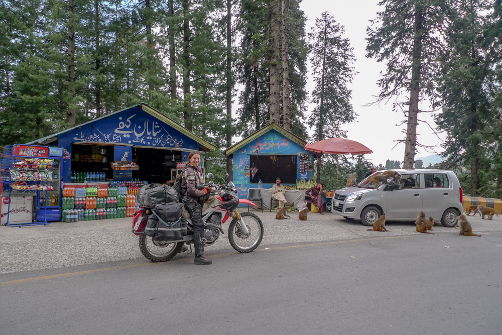
We chug the entire route back to Murree and ride north again through the Ayubia National Park. Although the landscape and the climate is not tropical, there are plenty of monkeys around and “the child” (Miriam) feels at home. The view of the valleys is fantastic, but a thunderstorm is approaching.
Just as we have almost escaped the rain, it starts to pour out of buckets. Since we are not wearing any rain gear yet, we start crouching desperately under a small tree. It doesn’t take very long until we are pretty wet and cold. Suddenly two motorcyclists come by and, to our horror, start standing under the same ridiculous tree. It is Hamdan and Ibrahim from Lahore. All four of us quickly agree, that this rain protection is no longer of any value and we decide to continue to the next better shelter. Finally, a small tea house next to the road offers a protective canopy. We warm ourselves with tea and talk a few words. After the two lads realise, that we don’t really have a plan for North Pakistan, they suggest to join their tour. What could be better than a few locals to show you around? So we are very happy to follow them, of course.
After the rain has subsided a bit, we ride the remaining kilometers to Abbottabad. Our two companions wanted to reach the next bigger city at first, but we get stuck in heavy traffic and it starts getting dark. So we take a hotel in Abbottabad.
The next morning the weather is rather unsettled. Sunshine and heavy rain are alternating the whole day. Our plan was to ride over the Babusar Pass before it closes at 6 pm. We are too late though. Hamdan’s bike falls over and we have to find a welder for the side rack. In the end we have to spend the night in the small village just before the pass. As soon as the sun disappears, it gets uncomfortably cold here. The amount of blankets in our simple room has already suggested that. All the villagers have blankets thrown over to keep them warm. For this reason, we don’t sit very long anymore after dinner and rather prefer a reasonably warm bed.


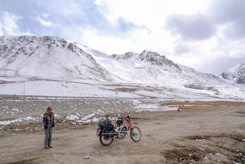
The Babusar pass altitude is almost 4200 m.a.s.l. Once at the highest point, it is extremely windy and much colder than down in the valley. While a normal tourist stands and freezes here even with a down jacket, there are also one or two locals, who actually seem to feel comfortable in their t-shirts only.
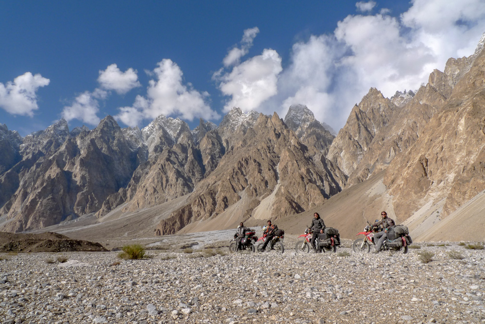
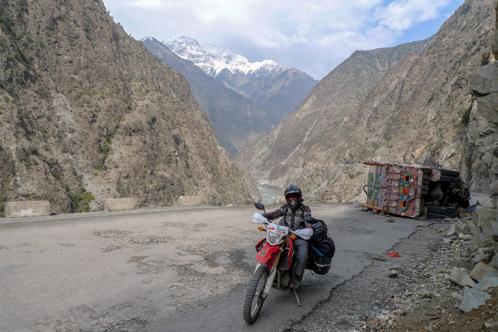
We take a few selfies with the local tourists and then quickly continue to reach the slipstream on the other side of the pass. It is almost an altitude difference of 3000m, where the winding pass road leads through quaint little mountain villages down to the valley. The sun comes out a bit and we can warm up again. Shortly after Chilas we turn back onto the Karakoram Highway and drive north.
A few kilometers later we come to Jaglot. The three highest mountain ranges in the world meet in Jaglot – the Himalaya, the Karakoram and the Hindu Kush. In a distance you can vaguely discern the notorious Nanga Parbat (8125 m) covered by clouds.
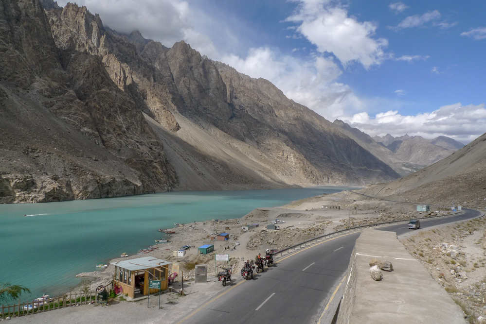
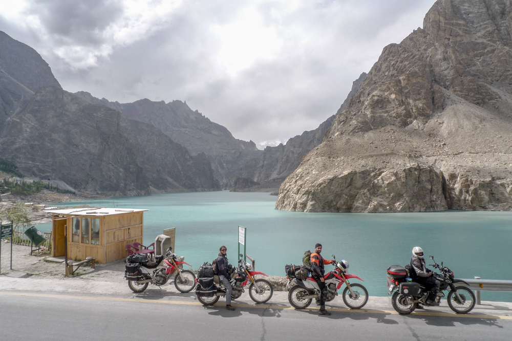
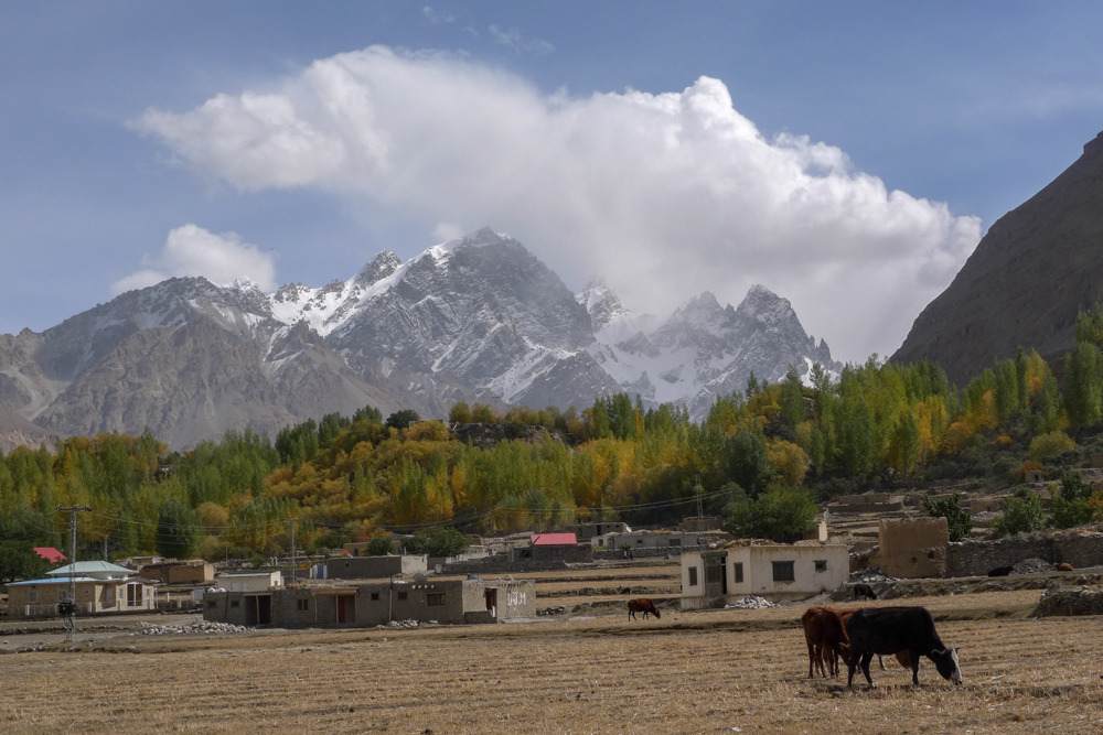
Our goal is to reach a hotel in Passu. After we have passed Gilgit it is already clear, that we won’t make it. Hamdan has a flat tire and when we are in the next larger town at a gas station in Ali Abad, it is already pitch dark. A slightly hyperactive local brings us to a small, cheap hotel, that is currently undergoing major renovations. Probably the price is low for that reason, but we have a fantastic breakfast terrace with a direct view of the 7788 m high Rakaposhi. Unfortunately it is always too cloudy to see it completely.
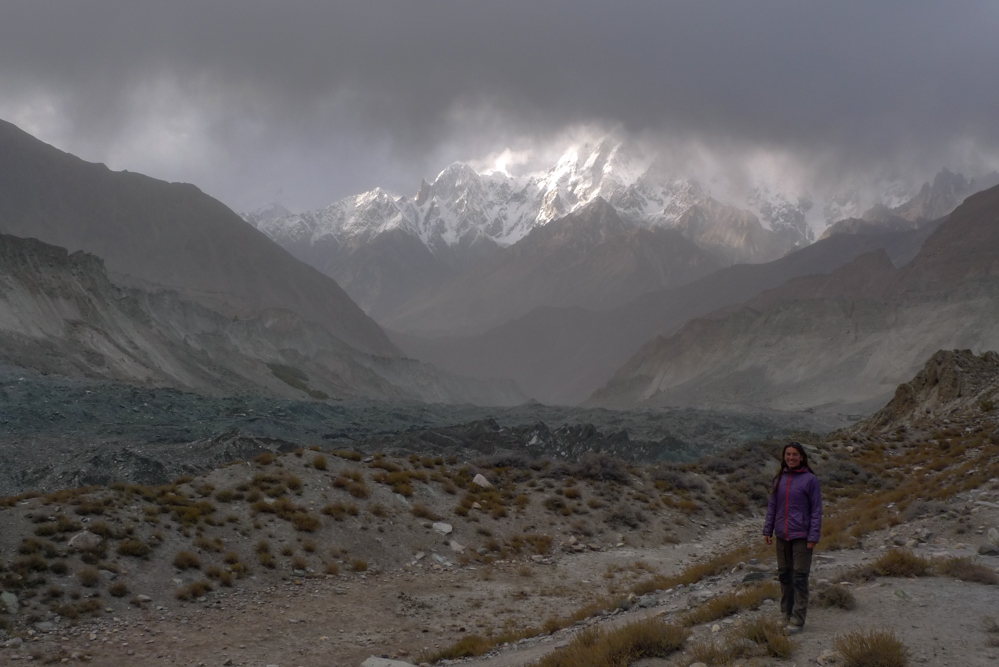
Afterwards we start riding to Passu. Before you reach the village, you can already see the mighty Passu Glacier on the left and the impressive Passu Cones in the north. With just over 6000m, they aren’t very high comparatively, but the whole mountain consists of hundreds of small cathedrals and offers an incomparable sight.
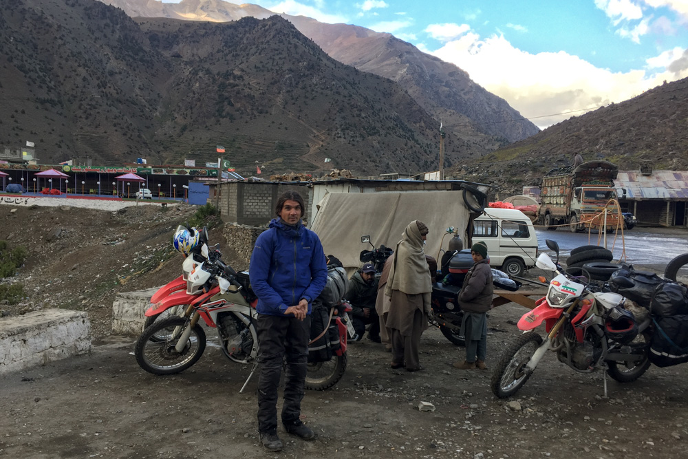
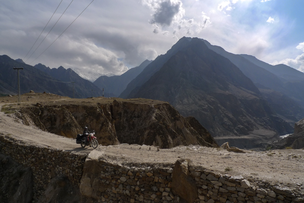
We chug on to Sost, the last larger town before the Chinese border, and then turn onto a small gravel road into the Chapursan Valley. The little road is a dead end and leads through tiny mountain villages almost to Afghanistan. You can find our detailed report here. The area looks similar to the Tajik Pamir Mountains and, if you look at the map, that’s not surprising at all. We are very close to Tajikistan again, where we were a few months earlier. Only the narrow, a few kilometers wide Afghan Wakhan corridor lies in between
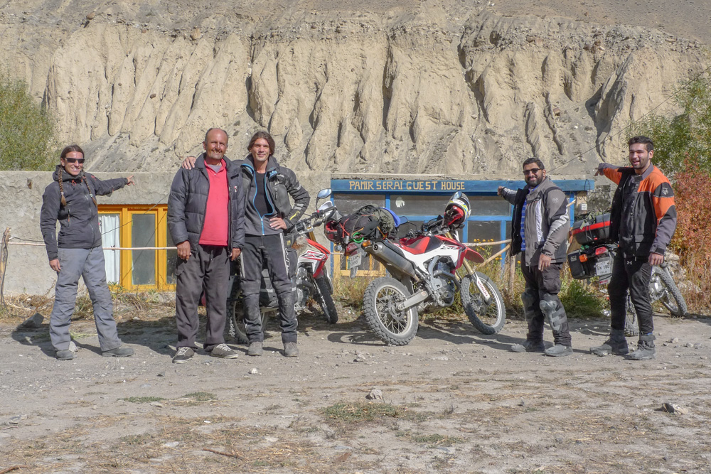


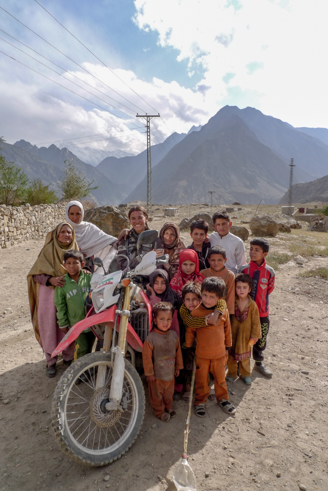
After 2 hours of great riding it is already quite late again and we are looking for accommodation. A tall man in a pickup truck comes towards us (it’s the only car far and wide) and shows us his little homestay. He is also the only person here speaking good English. It became very fresh in the meanwhile. With long woolen underwear and a down jacket, we sip tea on the terrace. A little girl is standing next to us. She is maybe 4 years old and wears a T-shirt, a short skirt and stands barefoot on the stone floor. Apparently she doesn’t know the word “freezing”.
The owner of the homestay, Alam, is a tour guide for this area and also helped Lonely Planet for this area in that time. He says we can continue to the nearby glacier the next morning without a permit, but after that is a military check post, where we could not pass.
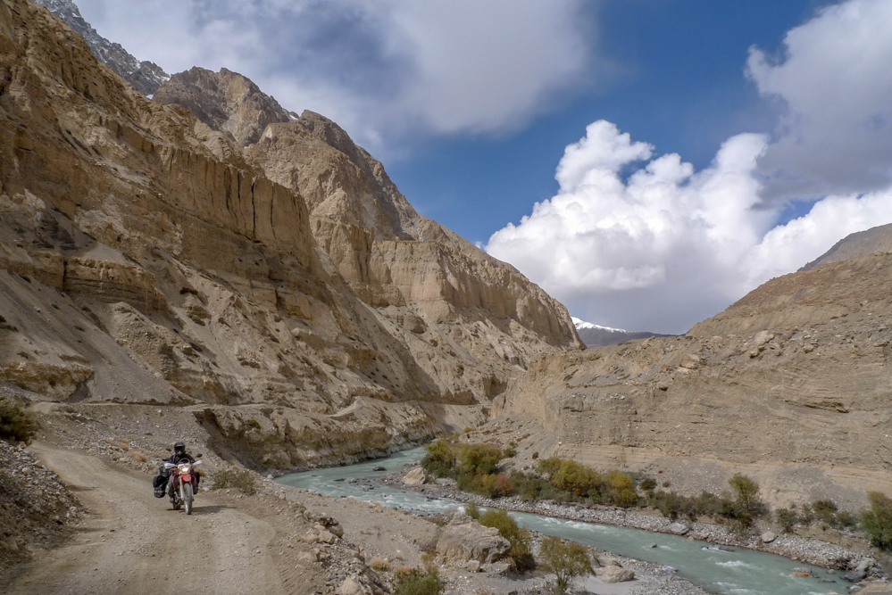
So after breakfast the following day we ride the few kilometers to the glacier. Unfortunately, it is too far from our route to walk there briefly. The area is wild and lonely. In a few days the first snow will come and then the valley will be isolated. Miriam asks, what the residents do in case of a serious disease in winter time. The tall, strong man simply replies: “People are dying, that’s the way it is!” – Miriam gets big googly eyes…
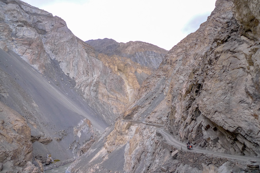
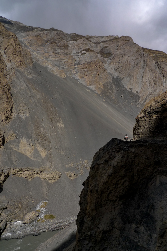
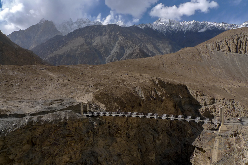
Around noon we are back at the Karakoram Highway. We have a bite to eat in Sost. You can already tell from the menu, that China is very close. Then we roll back to Passu and turn into Shymshal Valley (also check our specific report here). The valley is very narrow at the beginning. We drive right next to the raging river and massive rock walls. The route conditions become significantly more exposed after a few kilometers, when the road finally leads hundreds of meters above the river through the valley. It is just wide enough for a car to drive on it. Sometimes there are widenings to avoid oncoming traffic. Numerous exciting suspension bridges allow you to constantly change the side of the valley. There are no guard rails or fences and you should definitely avoid getting off the road here.
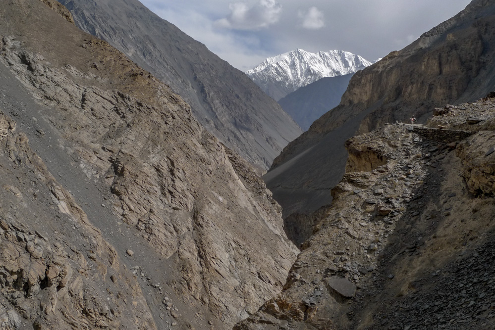
The further you drive towards Shymshal, the wider the valley becomes. About halfway we pass a pitch-black glacier. This road is also a dead end and the entire distance to Shymshal is ~50 kilometers.
You can’t go really fast, so it is already dark when we arrive in the small village. After dinner we sit in the garden around a small campfire. A few locals join us. Almost everyone here in Shymshal is a mountaineer. Some organise hunting tours, others say casually, that they install fixed ropes for the expeditions on K2. After a while I ask, if they also would like to climb the top of K2 one time, since they are already working there anyway. The simple answer is, that they have already been there twice.
We start to realise, that there are a lot of humble world class mountaineers in Shymshal. They all guide the famous international expeditions, but they are just never really mentioned in the excursion reports. It is a fantastic night at the campfire.
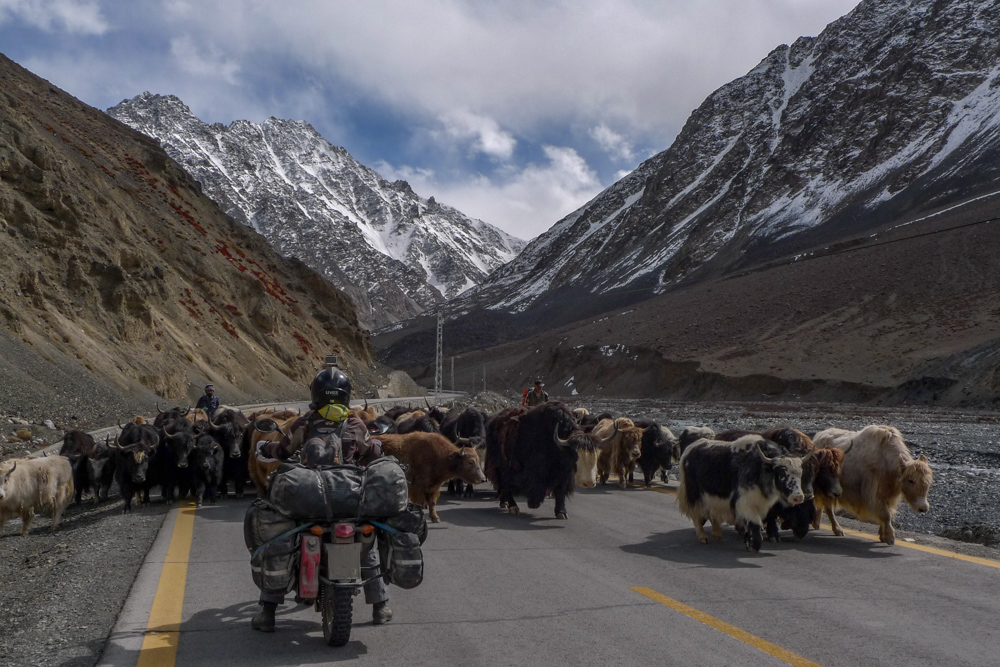
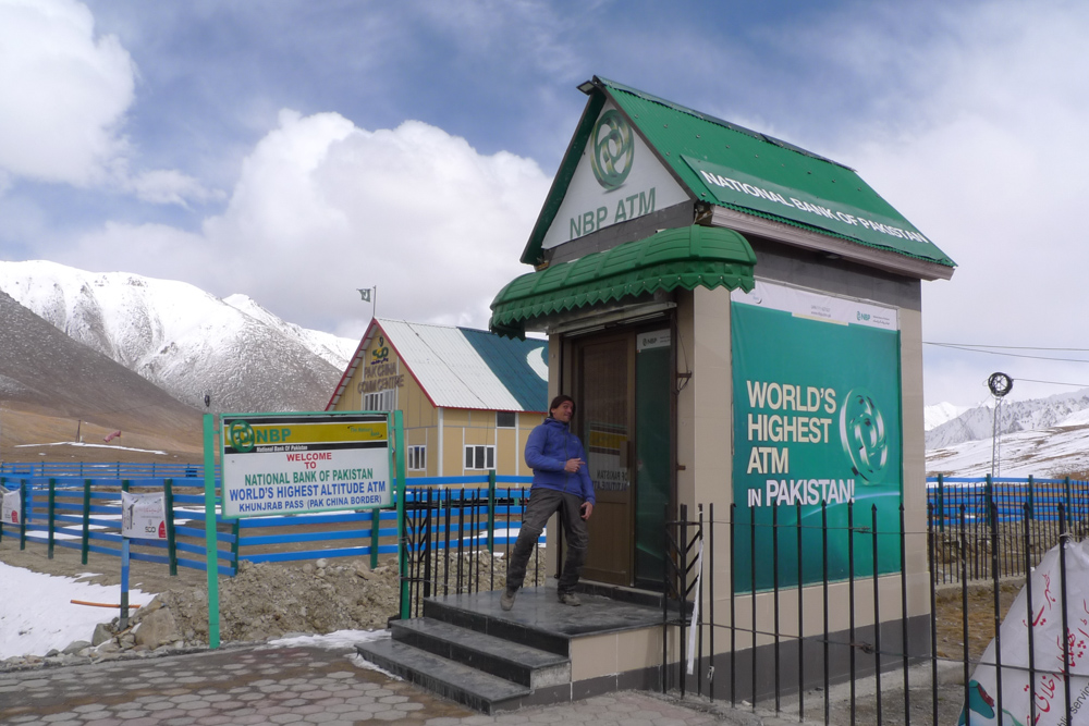
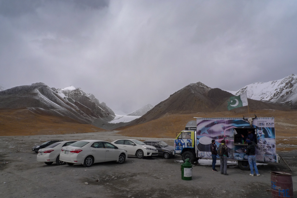
Hamdan and Ibrahim begin their journey home to Lahore the next day. Since we still want to take a few photos and take the route back more comfortably, we say goodbye to them. We will visit them again in Lahore. Back in Passu, we stay in a small hotel and take a tour to the Chinese border the next morning. The border is at 4700 m.a.s.l. (15420 ft) and the road leads through the Khunjerab National Park. There is not much traffic at this time of the year. You only have to watch out for the yak herds, that sometimes take a leisurely stroll on the street just around a bend. The last climb to the border is a steep zigzag road. The customs buildings themselves are on a small plateau. Next to them is an ATM with the inscription highest ATM in the world. Tobi tries to withdraw some money for fun – without any success though. There is no snow yet, but the temperature is almost 0°C (32°F). A cutting wind doesn’t make the whole area more pleasant. The few people here gather around an old truck, that sells hot drinks and snacks. We are invited to a hot tea, until the owner of the truck shop suddenly mentions, that a snow storm is coming and we rather should leave back into the valley.
Due to the low temperature and the low oxygen level, our bikes don’t start really well. When we finally ride back down the first steep pass, you can already see a large cloud full of snow approaching. It was a good advice to leave the top of the pass as soon as possible.

We make our way back to Gilgit. In between we spend the night in the same hotel in Ali Abad, as we already did on our way north. The owner recommends to go to the Hopar Valley and see the Hopar Glacier. The tiny pass road leads again about 20 kilometers into a dead end. It takes us almost 1.5 hours and, when we finally arrive, it is already afternoon. A nice guide tells us about a hike to the next glacier, which is supposed to be snow-white. Two hours to reach it, and 1.5 hours back would be just enough, but we have to be back before darkness. We remember – hiking time specifications in the Alps are usually rather easygoing – so that shouldn’t be a problem.
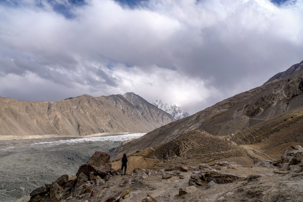
On the first part of the hike you walk directly over the Hopar Glacier. Once you stand on the glacier itself, you notice the enormous size of it and how difficult it can be to find the way. All directions are just plain ice. A few sparse stone men finally show us the track. Although we hike at a good pace, we can indead see the white glacier from above after two hours, but we are still far from the glacier itself. If you want to do this in two hours, you have to know the way and literally jog. So we finally have to turn around. Shortly before it is dark, we are back at the parking lot and roll the pass road back into the valley.
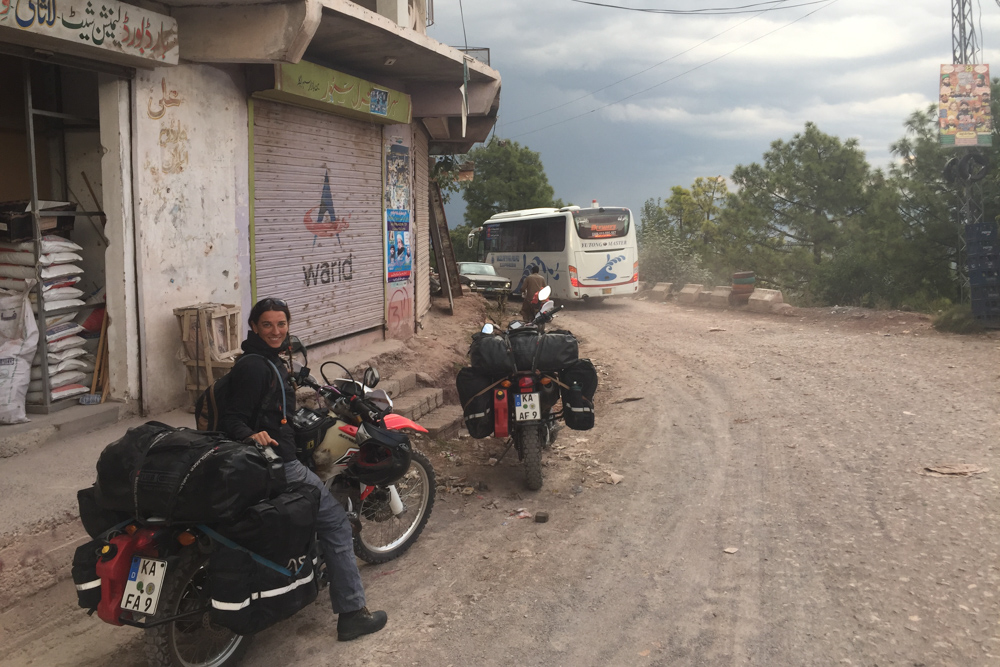
The next morning we pass Gilgit and turn east towards Skardu. The relatively good and asphalted Karakoram Highway becomes a partly uncomfortable dirt road to Skardu. At that time they have lot of road works going on to widen the street. After a few kilometers we turn onto a tiny pass road into the Haramosh Valley. Many arduous switchbacks full of rocks later, we finally end up in a small village. It doesn’t really seem to go any further here. The villagers gather and call someone, who speaks a few words of English. Miriam receives jewelry from the ladies. Although she doesn’t want to accept it, she has no choice in this regard. We get told, that there is no way to ride deeper into the valley. So we have to turn around and are accompanied by two men on a tiny motorcycle back to the main road to Skardu.
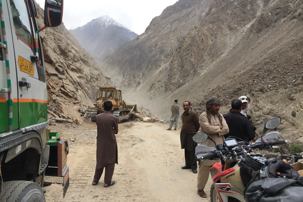
We need significantly longer than expected for the 150 kilometers to Skardu. There is a lot of traffic, the road conditions are bad and they have rock blastings now and then. That means – waiting until an excavator has cleared the road again and it can take between 1 to 6 hours. Some smart locals have already set up temporary stalls to sell e.g. fruits and drinks. One of the gentlemen wants to invite us to tea. When we finally want to drive on, Miriam’s rear wheel is flat. Fortunately, there is a motorcycle service a few meters away – so I don’t have to unpack all my tools on the road. Three old rims on top of each other to jack up and half an hour later, Miriam’s tire is repaired. However, it has become dark and we decide to roll back to the place, where we just had tea and take a cheap motel room.
After a good night’s sleep, we drive the rest of the way to Skardu. Skardu is the starting point for all hikes and expeditions in the K2 region. Everyone that wants to go to K2, inevitably comes via Skardu and then continues to Askole. It is a pretty busy town. Originally we wanted to ride south via the Deosai National Park, but it is already closed due to snow fall. When we asked the locals about the condition of the road to Askole, we are advised against this route. Unfortunately we are a little bit too late in season. The K2 Trek is also no longer possible at this time of the year. So we have no choice but to take the same route back to the Karakoram Highway. We are a little disappointed and look for a place to pitch our tent.
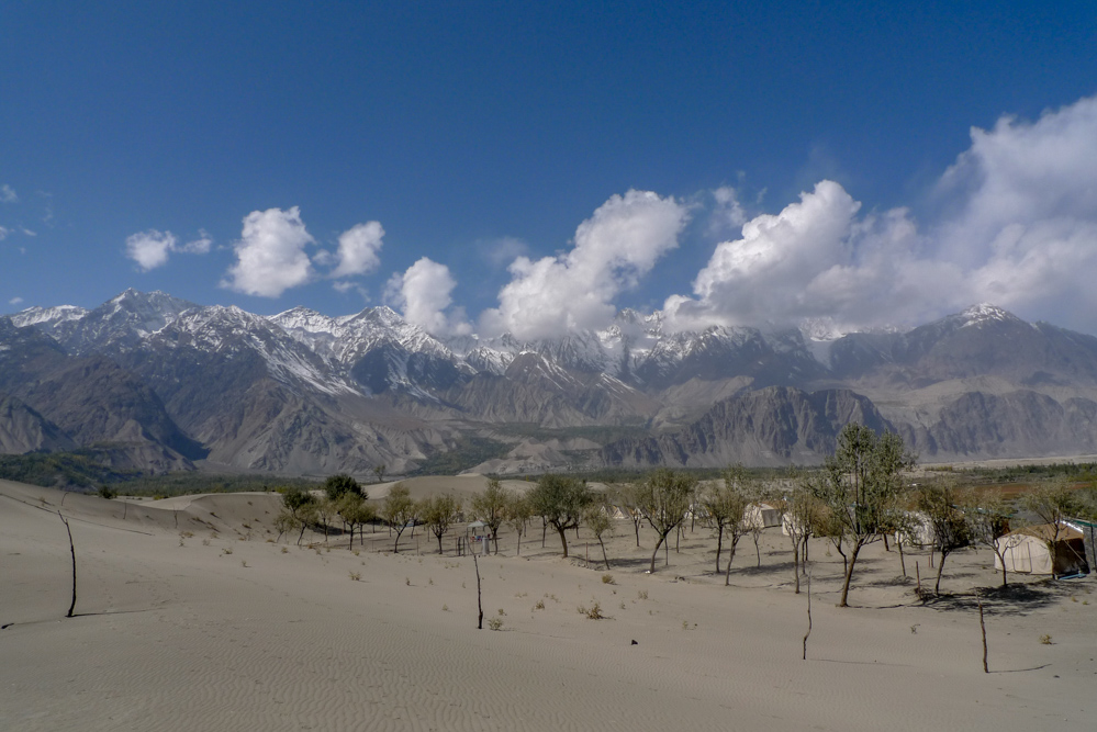
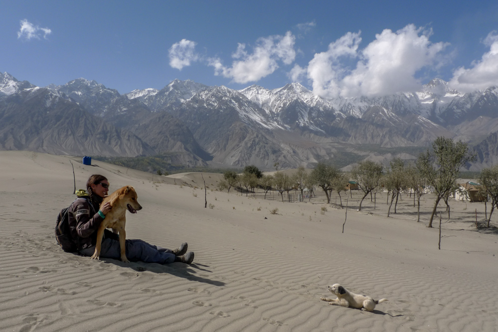
Right next to Skardu is the Katpana Desert, a cold desert with great sand dunes and a fantastic view of the surrounding mountains. The cold desert borders on a lake and we find a small grove there – a perfect place for a campsite.
The next day we climb the sand dunes and then gradually make our way back.


At approximately half of the route there is another road blast. Before we even get there, a local advises us to have a cup of tea somewhere first, as the whole action will take a while. When we pass a sign that says “Canteen” and a lot of people are sitting there, we park our bikes, sit down at a table and order tea. After a while we pay and drive to the location of the blast to get an idea of the situation. We wait about two hours and when it is getting dark again, we decide to go back to the “canteen” to ask for a place to stay and have dinner there. When we stop in front of the canteen, a car stops to tell us, that this is not a restaurant and we should follow them. At first we look at each other a bit puzzled – we have already ordered tea here before. So we just ignore the statement made by the passing car and take a seat, like we have already done before, to order some food. When we ask for the menu, there is none – “Ok, so what do you have to offer?” – “Maybe scrambled eggs” – “Sure, if there is nothing else, scrambled eggs are completely fine!” – What kind of a weird restaurant is this, I mumble to Miriam. They bring us nice scrambled eggs and they even organise some extra dal (lentil soup) from a building across the street. A couple of lads shyly ask, if they can join. We ask them for an overnight stay, or if it is possible to pitch our tent here in the yard. “It would probably work, but maybe there is a better option in the military barracks.” – “Barracks, which barracks?” – “Yes, the building across the street. We’re sitting here in the barracks canteen!” – “Oh, that’s not a restaurant?” – “No!” – No wonder the menu is so sparse, but nobody has told us before, that this isn’t a restaurant. They probably just thought, it is less effort to let the stupid tourists believe it is a restaurant – rather than to explain to them arduously, that this is a barracks canteen in reality. We apologise for the misunderstanding. The lads take it calmly and seem to be happy, that we got lost here. We are not allowed to pay anything in the end – it’s not a restaurant either. After a while a soldier comes from across the street and says, that he has organised a place to sleep for us. We are given a small room with a bathroom. When we want to pay the next morning, it doesn’t cost anything either.
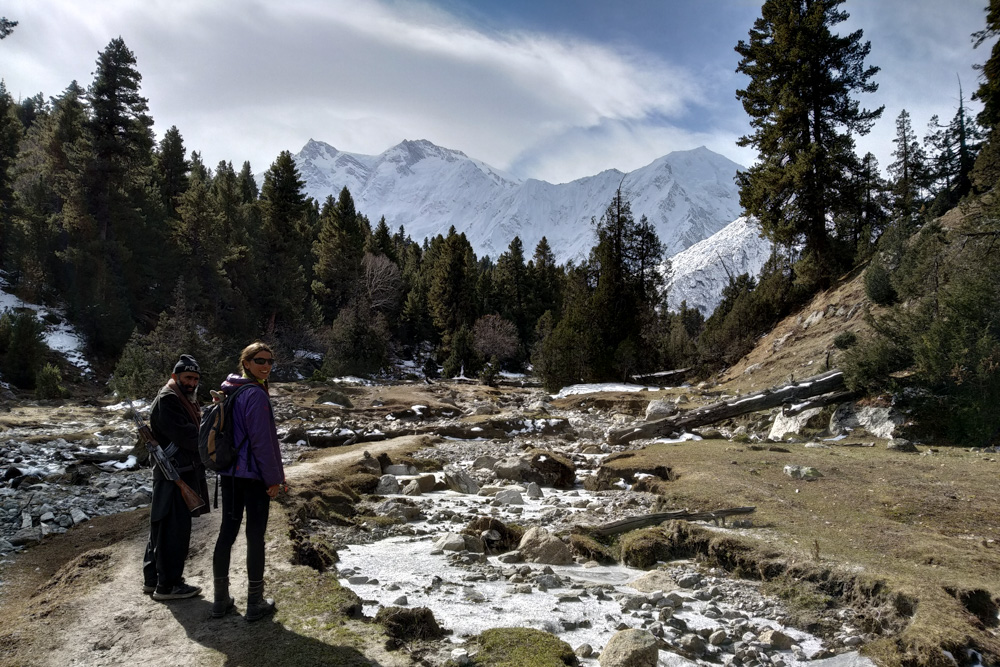
Fortunately, in the morning we can leave the construction site behind us before the next blast. Back on the Karakoram Highway, we drive to Jaglot and have lunch there. The weather is pretty good. A few kilometers further we come to a lookout point on Nanga Parbat – it is free of clouds. Therefore we change our plan and ride to Fairy Meadows below the mighty Nanga Parbat instead of driving to Astore.
When we stop briefly at the junction to Tattu, a few locals ask for money to use the road. They belong to the jeep service and take care of the “road” into the valley. We are glad, that they let us pass, because we got told before, that you are usually not allowed to use this route with your own vehicle at all. They ask again, if we know what we’re doing and, after we gave them some money, they say goodbye in a friendly manner.
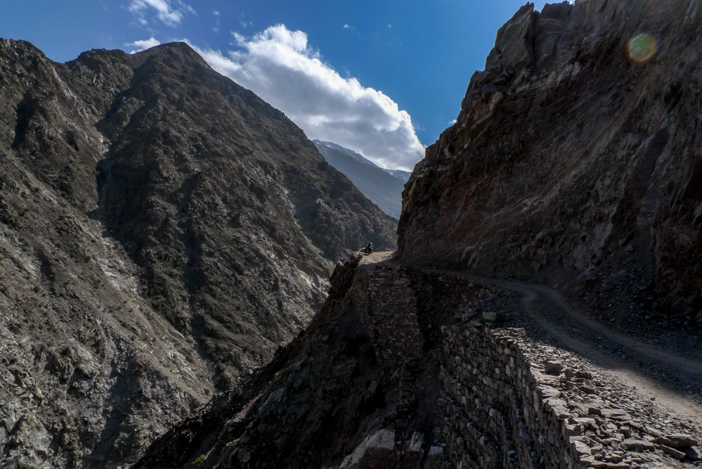
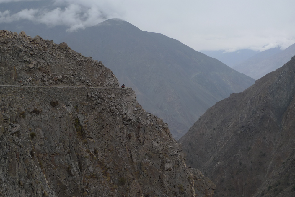
The condition of the small pass road can be described as adventurous (more infos here). There is no comparison to any of the dirt roads before. Large, loose boulders are everywhere and the road is sometimes extremely steep. For the first time, we would like to have a little more horsepower. If you stand on a slope and the engine no longer manages to turn the rear wheel, even in first gear, you have definitely reached the motorcycle’s performance limit. The fact that it goes down hundreds of meters laterally, doesn’t make the situation more pleasant.
Shortly before Tattu, the track becomes better again and we have time to enjoy the great view. This route is another dead end and shortly after Tattu it ends at a river. From here you have to walk the remaining kilometers to Fairy Meadows. A policeman is kind enough to put our luggage in his hut. We just park the motorbikes at the end of the street.

The hike to Fairy Meadows is steep and strenuous. According to the locals, it is incredibly crowded in high season. However, at this time of the year, we are all alone. After 2/3 of the hike, the path goes through a small forest with a few huts and restaurants. Three policemen sit in the last opened restaurant. We have a Doodh Pati Chai (black tea made from milk) together and they accompany us the rest of the way to Fairy Meadows.
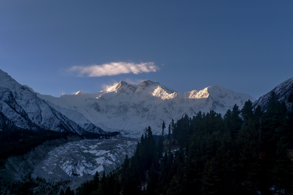
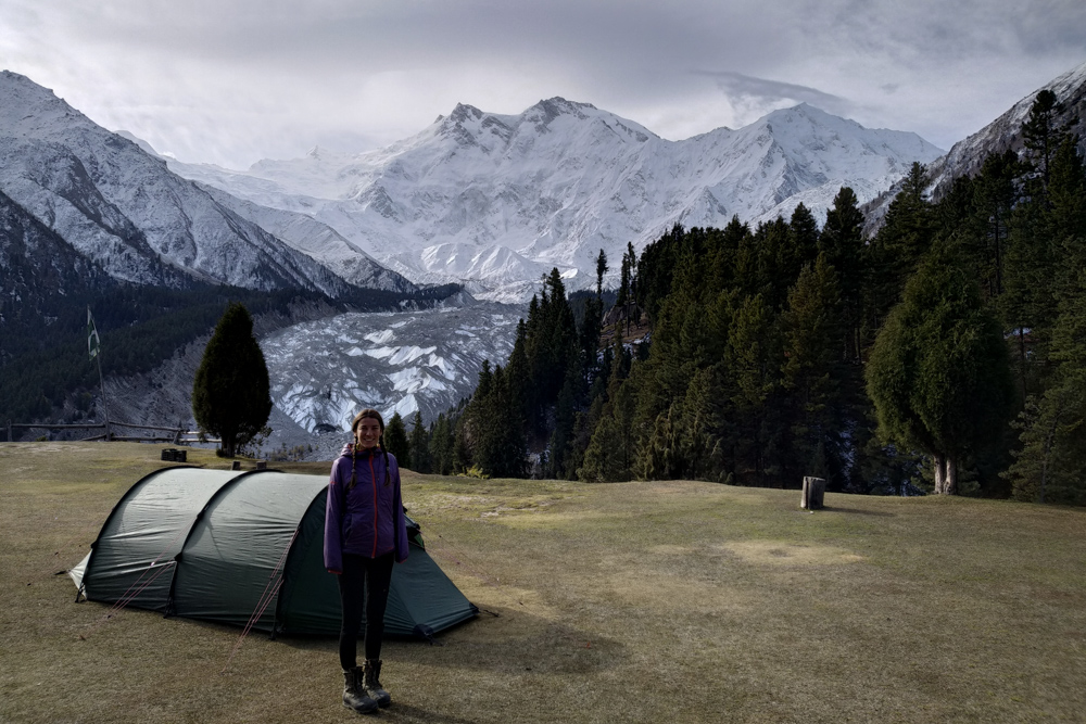
Even this place is almost deserted and we get a fantastic campsite on a meadow all alone with a direct view of Nanga Parbat. In the evening it drops to freezing temperature and we are happy, that there is a lounge with an oven.
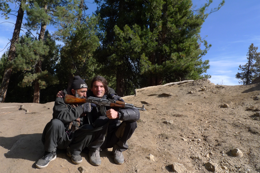
The next day we go for a day hike to base camp 1. A few years ago some tourists were killed on the other side of the mountain. So nowdays they give you an escort for all walks in Fairy Meadows. Our guide is 52 years old, has a long beard and doesn’t look motivated to hike at the start. Of course he is equipped with a Kalashnikov. During the hike he slowly warms up and finally suggests to hike to base camp 1 by himself. Another group has told us before, that there might be too much snow already. Therefore we were not sure in the beginning, if it is still possible.
On the way we pick up a Polish couple, whose guide probably doesn’t feel like walking that far. The higher we climb up, the more snow is all-around and you have a constant view of the mighty Raikhot Glacier. At base camp 1 is already about 20cm (~8 in) of snow. A commemorative plaque shows the first person, that reached the summit – Herman Buhl. Nanga Parbat is not the highest of the Eight-thousanders, but by far the most climbers died here. That’s why the locals simply call it Killer Mountain. Base Camp 1 is at “only” 4000 m.a.s.l. (~13000ft). If you look up to the summit, it doesn’t really look that far anymore. However, as soon as you realise, that the distance to the summit is further, than from sea level to base camp 1, you suddenly notice the massive size of the main wall.
The weather changes and it looks like a snow storm is approaching. We have to start our way back. After a few hundred meters we see a horse running around freely. Our guide explains to us, that these horses are used by the expeditions to transport their equipment to the base camp. It must have run away and we should try to take it down into the valley, otherwise it will freeze to death in the upcoming weather. We carefully circle the horse and our guide throws his scarf around its neck. After a short fight, it stops for a while, but stubbornly does not want to move. Miriam is supposed to ride the horse first, but she is not an experienced rider and it doesn’t move a bit. So Miriam gets off again and he pushes the scarf into my hand to pull hard, while he hits the poor horse from behind. It doesn’t move at all, until he finally uses the shaft of his Kalaschnikow. Stubborn animal!

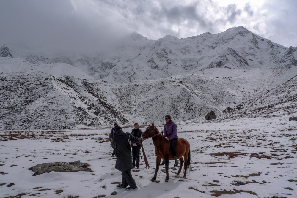


When things finally get going, we start the arduous descent to Fairy Meadows. The way back leads a few kilometers along a steep slope. The path is actually too narrow, that a horse could comfortably walk there. It refuses to go any further again and again, which ends with me pulling the front of the scarf like crazy and Miriam and our guide hitting the horse on the back. The girl from the Polish couple has to carry the Kalashnikov.
As it becomes stubborn again at a particularly steep spot, it finally slips and takes a header a few meters down the slope. Luckily nothing has happend to the horse, but you can literally see, how it is shocked. Although it wasn’t nice to watch it falling at first, its stubborn will seems to be broken afterwards and it finally starts to walk itself. For the present, our guide goes ahead, followed by the horse on the scarf. Miriam holds its tail, which apparently gives it more safety and I make sure, that it doesn’t want to break out sideways. After a few kilometers the trail leaves the slope and leads back to Fairy Meadows on a plain terrain. From here on the horse can even run by itself and we just have to watch out every once in a while, that it doesn’t run away.
When we reach our camp it is almost dark. It has already become significantly colder and we quickly retreat to the warm lounge with the oven.
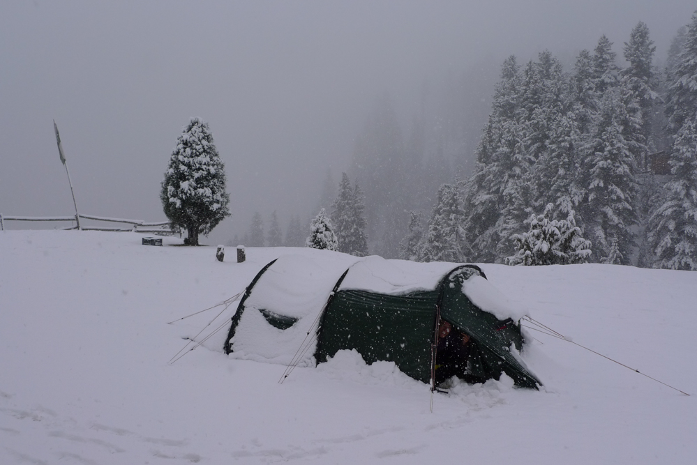
This night we almost reach our camping comfort limit. We are told later, that the temperature was -10°C (14°F). When Tobi opens the tent the next morning, he is flabbergasted. It has 20cm (~8 in) of fresh snow and looks like deep winter. We are worried, that there is also snow on the difficult Tattu pass road, where our motorbikes are parked. The route wouldn’t be ridable in snow. So after breakfast we make our way back to our bikes quickly. Fortunately the snow line is a little bit higher and the road is snowfree – it’s just wet. Riding downhill is much easier for us than uphill and, after just under an hour, we are back in the valley on the Karakoram Highway.
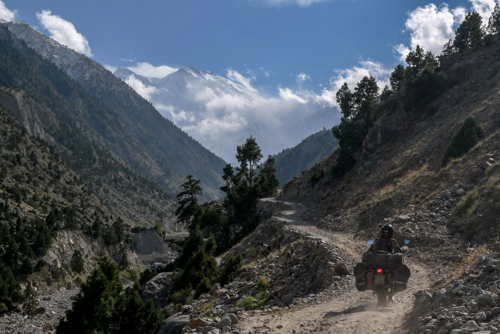
Our friends in Lahore have already informed us, that Babusar Pass was closed due to snowfall. For this reason we have to take the longer route south along the Karakoram Highway. We spend one night in Chilas and then continue towards Besham. The road is a moderate disaster. It is full of heavy traffic and construction sites, where you have to wait for a long time quite often.
Shortly before Besham, the road becomes smaller and winds spectacularly through the narrowing valley, small villages and finally along the slope. After one of the sharp bends, we suddenly face a lot of people on the street. What’s going on here? – Aha, some boys are playing cricket. Maybe not the best place, on the other hand there is no other place to play cricket either…
Besham is considered as a bit unsafe. We got told before, that this section of the Karakoram Highway will be escorted again. When we pass a police station a few kilometers from the city, they promptly command us to wait for the escort. We make it clear, that we don’t feel like we need an escort, that we have already travelled through Belochistan and really dont want it anymore. The police officers are a bit surprised at first, but they finally allow us to continue without escort. We feel quite relieved and ride the last kilometers into town – it has already become dark.
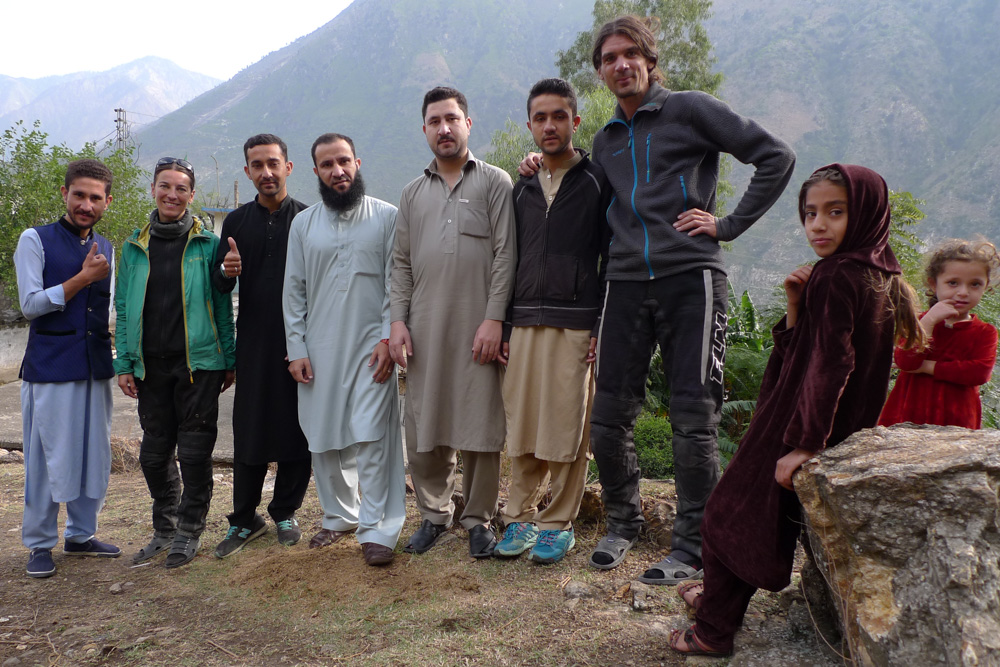
When I have just cleared a hotel room and I return to Miriam, she is already surrounded by a handful of men. One of them invites us to spend the night at his house. The hotel owner is not very enthusiastic and indicates, that this is not allowed in this region. The man replies, that he is known in town and he’ll clear it up with the police. Ultimately, this has also given us the feeling, that things are alright. The police briefly registers our passports and we follow our new host to his home.
Mubarak is the head of a family of around 50 people. They live in different houses and the settlement on the outskirts can almost be described as a small village. He basically looks like a “picture book” Pakistani with a bushy beard and works most of the time away from his family in Saudi Arabia. His behavior can be described as conservative. So we get the chance to visit a typically conservative Pakistani family – what is really cool, but also a bit special for us westerners – e.g. the women are not allowed to sit in the room with us, they actually only serve the food.
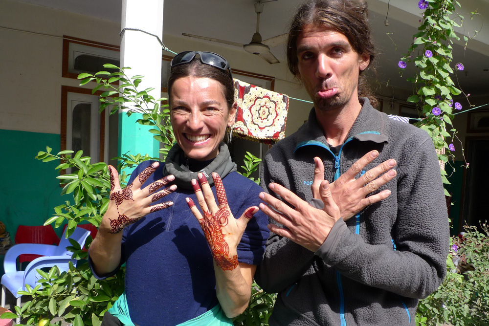

After breakfast the next day we visit his family. We go to all the houses, are introduced and take selfies, of course. His family is very nice. At the age of 34, one of the woman has already 9 children – she has really kept herself well for that. Miriam gets a traditional henna painting on her hands and we have a good time.
Afterwards we want to continue our journey. Mubarak wants to keep us for a few more days, but we have to decide against his will. We notice, that he doesn’t like our decision, but we have already made a date with our friends in Islamabad.
So after a goodbye, we chug back to Islamabad via Abbottabad.